
Rain by month
The National Weather Service's 1991-2020 normals show a pattern worth noticing: the wettest normal month is December, then March and February. September is the lowest. The page itself notes its figures "are not considered official data", so treat them as a good picture, not a certified record.
- 4.99Jan
- 5.11Feb
- 5.39Mar
- 4.86Apr
- 4.67May
- 4.06Jun
- 4.49Jul
- 3.55Aug
- 3.49Sep
- 3.56Oct
- 4.25Nov
- 5.87Dec
| Month | Normal | Record | Record year |
|---|---|---|---|
| January | 4.99 | 11.40 | 1937 |
| February | 5.11 | 13.63 | 2019 |
| March | 5.39 | 17.00 | 1980 |
| April | 4.86 | 14.00 | 1911 |
| May | 4.67 | 11.88 | 1983 |
| June | 4.06 | 14.99 | 1989 |
| July | 4.49 | 14.81 | 1967 |
| August | 3.55 | 12.61 | 1901 |
| September | 3.49 | 12.48 | 1906 |
| October | 3.56 | 12.06 | 1975 |
| November | 4.25 | 13.60 | 1948 |
| December | 5.87 | 18.68 | 1990 |
| Annual | 54.29 | 73.58 | 1989 |
What this means for gutters: leaves come down in the fall, and the wettest month follows. That link is reasoning from the calendar, not a study, but it's a good reason to think about a late-fall cleaning.
A big event shows the range. The National Weather Service's account of Christmas 2015 says: "3-9 Inches of Rainfall fell December 24th - 26th." The Flint River at Brownsboro crested at 22.99 feet, just under its 23.0-foot record.
Rain rate: the number gutters are sized for
Monthly totals don't size gutters. Short bursts do. NOAA Atlas 14 puts downtown Huntsville's 5-minute rate at 8.20 inches per hour for a 10-year event and 12.8 for a 100-year event. Over 60 minutes, those drop to 2.30 and 3.53. Values move slightly by address. The size calculator shows how to use these numbers.
Storms
- Tornadoes. The county EMA says: "Madison County had 142 tornadoes between 1950 and 2018." Statewide, most come in March to May, with a secondary season typically in November.
- April 27, 2011. The National Weather Service counted 39 tornadoes in its Huntsville area that day, and Madison County was hit 6 times.
- Seasons by hazard. An older NWS Huntsville study found that, historically, tornadoes peak in April and May with a smaller November peak (an August bump is mostly one 1985 hurricane outbreak), hail concentrates in March to June with May the most frequent month, and wind peaks in February to May and again in June to July. The tornado data runs 1950 to 2001, and the hail and wind months 1982 to 2001, for the 11-county NWS Huntsville area, so read it as history.
- Hail. For a severe thunderstorm, the county EMA uses "hail at least 1 inch in diameter". The 2016 county plan gives three-quarters of an inch and notes the criterion was set to rise to one inch in January 2010. This site found no reliable local hail count or recent-storm dollar figure, so it doesn't publish one.
For what to do after a storm, see hail and wind damage.
Freezes and winter
The National Weather Service's winter statistics give a normal first freeze on November 8, a normal last freeze on March 24, normal season snowfall of 2.4 inches, about 2 days of measurable snow, and a record low of -11. The county EMA says winter storms typically come in January and February, and the county's 2016 plan says of them: "Occurs almost annually with power loss."
No local source read for this site says ice dams are common here, so this site doesn't claim they are. Bob Vila says vinyl turns brittle in colder climates, so ask how it holds up through Huntsville's freezes.
Red clay: what the sources say
Red clay soils are real here, but the federal soil description doesn't call an extensive red soil series in the Tennessee Valley poorly drained. Alabama's Extension System describes the Tennessee Valley as having "mainly red clayey soils", with Decatur and Dewey soils extensive there, though it doesn't name Madison County. And the federal description of the Decatur series reads: "Well drained. Runoff is medium, and permeability is moderate." Its typical site is in Limestone County, Alabama.
That doesn't mean your yard drains well. Your lot may have been graded or filled, and the Madison County soil survey wasn't readable for this site, so nothing here describes a particular neighborhood. No government source read calls Madison County soils expansive, so this site doesn't either. If water stands in your yard, look at where your downspouts let out, and call the city or county if it's more than a downspout problem.
Karst and sinkholes
The Geological Survey of Alabama says north Alabama is "dappled with sinkholes, springs, and cave openings", and lists "Drainage problems" and "Excessive rainfall" among causes. A 2006 geology abstract counted "424 identified springs, 1886 mapped sinkholes" on Redstone Arsenal, a 154-square-kilometer federal site, not a neighborhood. The Big Picture Huntsville site puts area caves down to "karst limestone geology and the abundance of water". The county's 2016 plan rates sinkholes a Slight risk, saying "Usually small in size, but frequent."
What this means for you: the area has karst, and concentrated water near a depression is worth asking about. No source ties gutters to causing or stopping sinkholes, so this site makes no such claim. Take sinkhole concerns to the city or county.
Hills and hillside homes
Huntsville's flooding myths page says "more than 90 percent of drainage complaints come from residents not in the floodplain", and that many drainage issues occur on "properties located on the sides of local mountains." Big Picture Huntsville gives Monte Sano State Park "the highest point in Huntsville city limits", at 1,652 feet at a water tower.
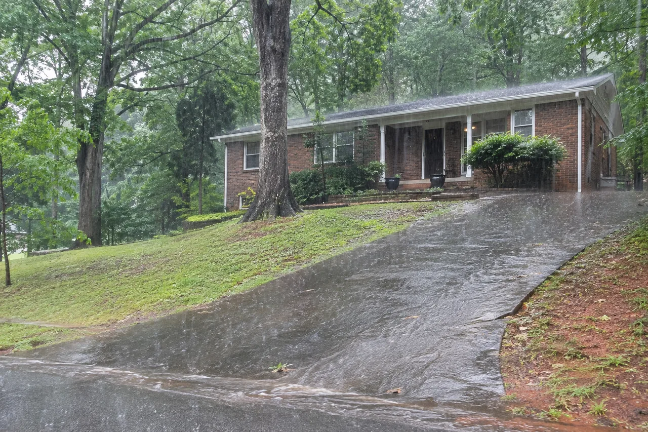
A third-party copy of the city's zoning code describes a Slope Development District, an overlay on slopes of 15 percent or more with 100 feet of relief that limits impervious cover. It counts "all area lying below the roof of any structure". No gutter rule appears in that text, and it doesn't name Monte Sano. If your home is on a mountainside, ask Inspection at 256-427-5331 what applies before any drainage work.
Trees
Big Picture Huntsville says "Much of the City of Huntsville is covered in trees". The city's planting list for one park names willow oak, overcup oak, red maple, sugar maple, river birch, southern magnolia, eastern redcedar and dogwood. A travel piece on Monte Sano describes "a canopy of hardwood forested trees". No source gives the tree mix by neighborhood, so go by what's above your own roof. See cleaning and guards.
What isn't known
Things this site looked for and didn't find in a usable source: how many local homes sit on crawlspaces, a recent local hail record, and any neighborhood HOA rule on gutters. On that last one, check your covenants and ask your HOA.
Questions homeowners ask
Is spring the rainiest time in Huntsville?
Not on these normals. December is highest at 5.87 inches, then March at 5.39 and February at 5.11.
Does red clay mean my yard won't drain?
Not by itself. The federal description of Decatur, an extensive red soil series in the Tennessee Valley, calls it well drained. Your own lot's grading matters, so look at where water actually collects.
Will better gutters protect me from a sinkhole?
No source says so. If you're concerned about a depression on your property, call the city or the county.
Which month has the most hail?
Historically May, according to an older National Weather Service study. No reliable recent local count was found.
Are ice dams a problem here?
No local source read says they're common. Freezes are normal from about November 8 to March 24, and season snowfall is about 2.4 inches.
How this site helps: if you need gutter work, your request goes to one independent local contractor. This site does no gutter work itself.
Related guides
Sources
- National Weather Service Huntsville: normals and extremes, 1991-2020; winter statistics; December 2015 rain; April 27, 2011 statistics; severe weather climatology, undated.
- NOAA Atlas 14, Vol. 9 v2. The raw file doesn't label its columns, so the rates follow NOAA's standard layout.
- Huntsville-Madison County EMA, natural hazards, undated; 2016 mitigation plan, April 1, 2016.
- Alabama Extension, major soil areas, reviewed July 2018; USDA, Decatur series, revised October 2004.
- Geological Survey of Alabama, sinkholes, undated; Redstone Arsenal abstract, March 2006.
- Big Picture Huntsville, December 31, 2019.
- City of Huntsville: flooding myths, modified December 3, 2019; planting list, October 29, 2023. Slope Development District text read from a third-party copy of the zoning code (Ord. 96-159, April 25, 1996; amended 2007), so confirm with the city.
- Bob Vila, gutter basics, modified August 20, 2021; Monte Sano travel article, January 25, 2026.